Introduction to EasyAR Mega
EasyAR Mega is a cloud - edge collaborative spatial computing technology designed to create a persistent and high - precision digital twin space for the entire physical world (such as a city, a campus, or a large shopping mall). With EasyAR Mega, your applications can achieve large - scale, high - precision indoor and outdoor positioning and virtual - real occlusion, bringing users an unprecedented spatial interaction experience.
This chapter will briefly introduce the core working principles, expected effects, and platform adaptation guidelines of EasyAR Mega from a developer's perspective.
Important
Non - developer users (such as product managers, operators, testers, etc.) can directly go to the Mega User Guide to learn about the Mega service.
Before You Start: Ensure the Positioning Service Is Ready
Before integrating the EasyAR Mega functionality into your application, you must ensure a core prerequisite: the Mega cloud positioning service is ready.
- On - site data collection is completed
- Use the specified device to collect data in the target area.
- Use the Mega Toolbox to collect EIF data for effect verification.
- Mega Block mapping is completed
- The positioning service is enabled and bound to the application
- Add the Block to the Mega positioning library in the development center.
- Obtain a valid App ID and API Key and configure them correctly in your project.
Important
If the above steps are not completed, the application will not be able to obtain positioning results, manifested as "AR content cannot be triggered all the time". Be sure to verify the service availability before development.
Basic Principles of Mega Positioning
Different from traditional GNSS positioning that relies on satellite signals, EasyAR Mega is based on advanced visual positioning technology. By matching the real - time image data captured by the user's device with the pre - built high - precision 3D data, the 6DoF pose of the user in the physical world is determined. Based on this pose, the application can render and overlay virtual content at the correct physical location.
The workflow is as follows:
Map Construction:
- Use professional equipment (such as panoramic cameras) to collect data in the target area.
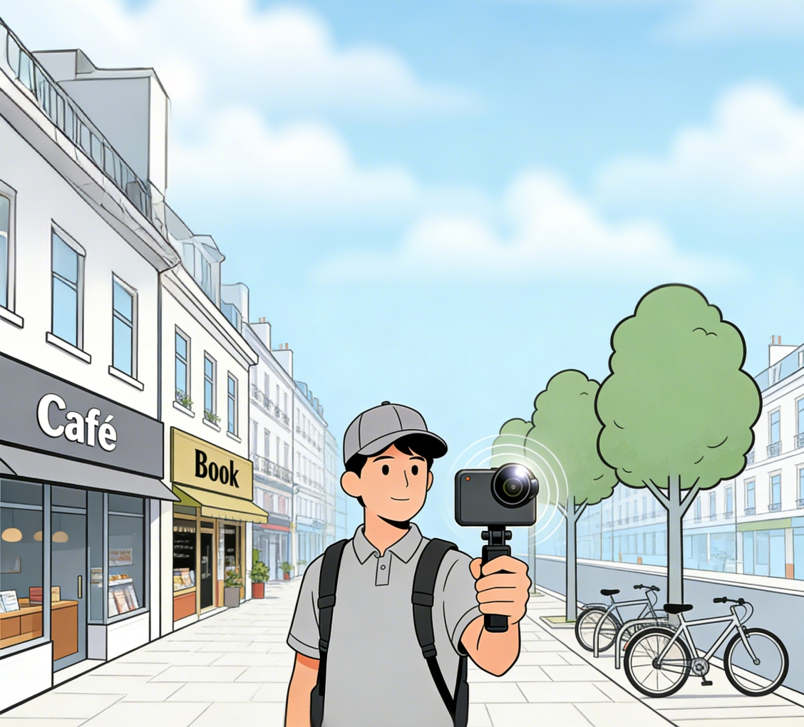
- Upload the collected data (such as .360 files) through the EasyAR mapping management backend.
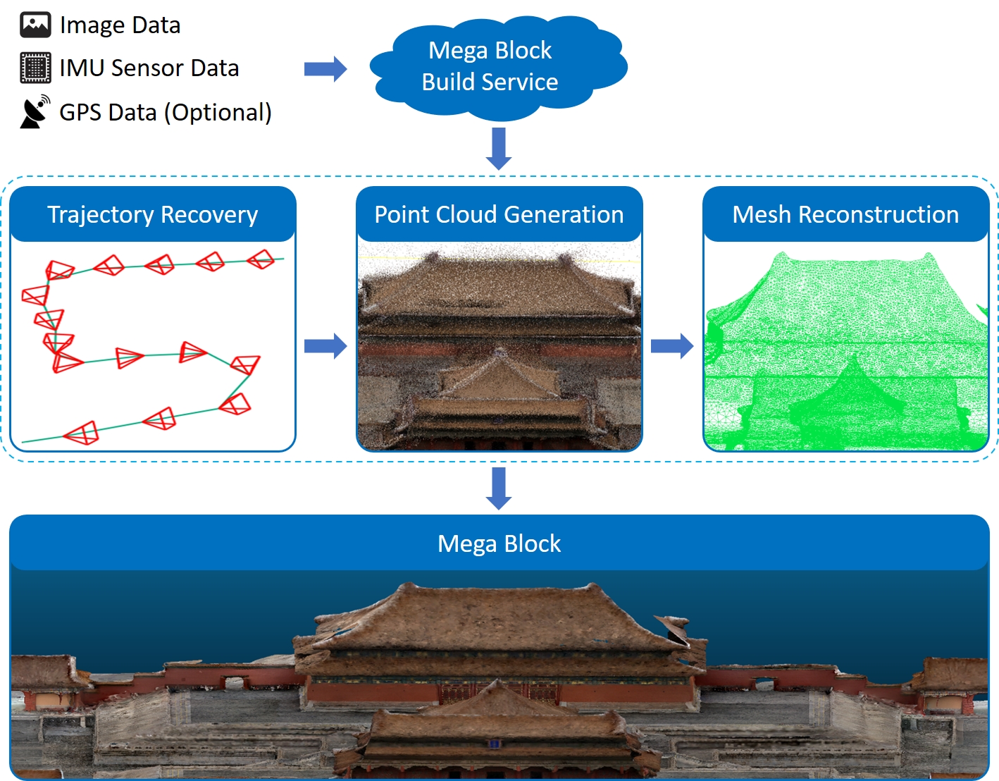
- The cloud processing platform will compute the images from the collected data, using advanced AI algorithms to extract the visual features of the target area; fuse the images with sensor information like IMU to recover the motion trajectory during collection (i.e., the camera pose at each moment); and subsequently generate a 3D point cloud of the entire scene, constructing a dense mesh with texture mapping.
- Ultimately, the mapping system outputs a high-precision "Mega Block map" defined by EasyAR, containing 3D geometric information and visual features. This map is the cornerstone of Mega localization.
- Use professional equipment (such as panoramic cameras) to collect data in the target area.
Real-time Localization:
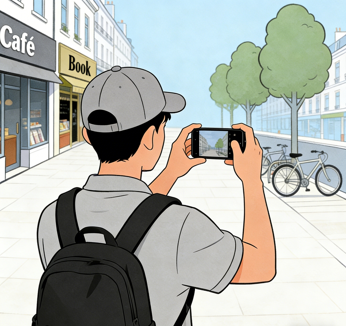
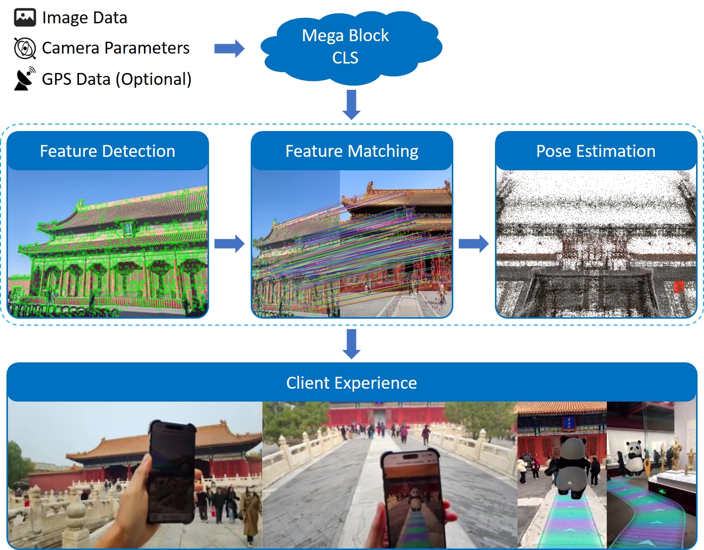
- The user opens the application, the device camera captures real-time images of the user's field of view, and sends this data along with camera intrinsics, extrinsics (if available), and auxiliary information (if available, such as GNSS) to the Mega cloud localization service.
- The Mega cloud localization service extracts the visual features from the uploaded images and performs rapid comparison and matching against the Mega Block map in the localization database.
- Once a match is successful, the system can calculate the user's precise current pose (i.e., position and orientation) in the map with centimeter-level accuracy.
- At this point, the Mega cloud localization service sends the calculated pose down to the application end, where it is fused with the device's own SLAM system for tracking.
- Finally, the application end obtains a real-time localized and continuously tracked pose, enabling virtual content to be displayed at pre-anchored positions in the physical world and to update continuously as the person moves.
- The user opens the application, the device camera captures real-time images of the user's field of view, and sends this data along with camera intrinsics, extrinsics (if available), and auxiliary information (if available, such as GNSS) to the Mega cloud localization service.
Effects and Expected Results
After successfully integrating EasyAR Mega, your application can achieve the following amazing effects:
- Centimeter-level accuracy: Compared to GNSS's errors of several meters or even tens of meters, Mega positioning can provide sub-meter or even centimeter-level accuracy, allowing virtual content to be stably "anchored" to specific locations in the real world.
- Persistent space: Virtual content can be placed anywhere in the physical world, and all users see consistent content at the same location.
- Real occlusion: Leveraging Mega's spatial understanding capabilities, virtual objects can be occluded by real buildings or obstacles, greatly enhancing immersion.
- Operation in GNSS-denied areas: In areas with weak or no GNSS signals, such as indoors, underground parking lots, urban streets with tall buildings, or forested mountains, Mega still provides stable and reliable positioning services.
The video shows a typical example of using EasyAR Mega:
- High-precision, persistent spatial positioning allows virtual content to perfectly adhere to building surfaces, presenting stunning dynamic videos and meticulously designed large-scale 3D posters.
- Real occlusion enabled by spatial understanding makes fireworks blooming in the sky and digital effects blend harmoniously with the surrounding environment without dissonance.
- With advanced visual algorithms, the entire experience remains robust in complex, crowded environments and operates stably even at night.
Possible non-ideal situations
Slow positioning recognition
In crowded areas like large event venues, network latency and concurrent requests may cause significant delays in Mega cloud positioning. Users might need to wait a while before virtual content appears.
Environmental changes causing errors
If the physical environment undergoes drastic changes (e.g., construction barriers, seasonal vegetation changes), positioning accuracy may decrease or be lost. Mega maps require regular updates to adapt to environmental changes.
Drift during continuous experience
Mega positioning fuses with the device's native SLAM system for tracking and keeps the camera active. Prolonged operation may cause device CPU throttling, leading to frame stuttering, dropped frames, or tracking scale drift.
Tip
For more details on abnormal effects or failures, refer to the Troubleshooting section:
Expansion Suggestions
If you encounter many non - programming - related issues during the integration of EasyAR Mega, such as service failures, scenario changes, and business expansion, please visit our Mega User Guide.
In this guide, you can find:
- Service creation: See how to create a Mega service and perform simple fault troubleshooting.
- Effect optimization: Learn how to preview the running effect, collect abnormal data, and conduct cold - start monitoring.
- Persistent operation: Understand how to handle scenario changes, business expansion, and migration/upgrade requirements for long - term operation.
- Business docking: Get familiar with the use of practical business data such as navigation road networks.
- Reference resources: Operation manuals for practical tools such as the Mega Toolbox.
Through this article, we hope you have a clear understanding of the working principles and effects of EasyAR Mega. Next, you can start preparing for your first Mega project!
Platform - Specific Guides
The integration method of EasyAR Mega is closely related to the platform. Please refer to the following guides for development according to your target platform:
- Enable Mega
- Quick Start
- On - site Use and Simulation Run
- AR Session Best Practices
- Add Tracking Targets
- Add 3D Content Aligned with the Real World
- Environmental Occlusion
- Control the Tracking Process
- Quick Verification Using a PC Camera
- Simulation Run Using the Session Verification Tool
- Use Its Domain LCC 3D Gaussian Splash Data
- Component Reference